BEYOND
Early access · Free

What BEYOND Maps does

BEYOND Maps is a free 3D map of the Alps for off-piste skiing, snowboarding and ski touring, in the browser. It shows lifts and pistes, slope angle, aspect and sun and shadow on 3D terrain, with today's and tomorrow's avalanche danger from the European warning services drawn on the slopes. You can draw routes, get tour times, run a SLABS avalanche-terrain analysis for an area, and download the area you ride as a 3D model or HTML page, so the 3D map is in your pocket without a connection. The website adds bulletin pages per region for Switzerland, Tyrol and France. Free account, nothing to install.

It is early access: everything is free right now, and we are still building.

Open the map Free · in your browser · free account

Available now

These parts are live and free to use.

In the map

3D terrain, from Nice to Salzburg

The Alps as 3D terrain in your browser: 10 m for Switzerland, Austria, France and Italy, 30 m (Copernicus) in the remaining gaps such as Berchtesgaden and Slovenia, and 2 m on demand when you zoom in over Switzerland, Austria or France. Base maps: winter relief with a snow-line slider, relief shading and forest, or plain. Contour lines, names and glaciers.

  • 10 m terrain, 2 m on demand
  • Winter relief and contour lines
  • A notice on coarse data and on glaciers
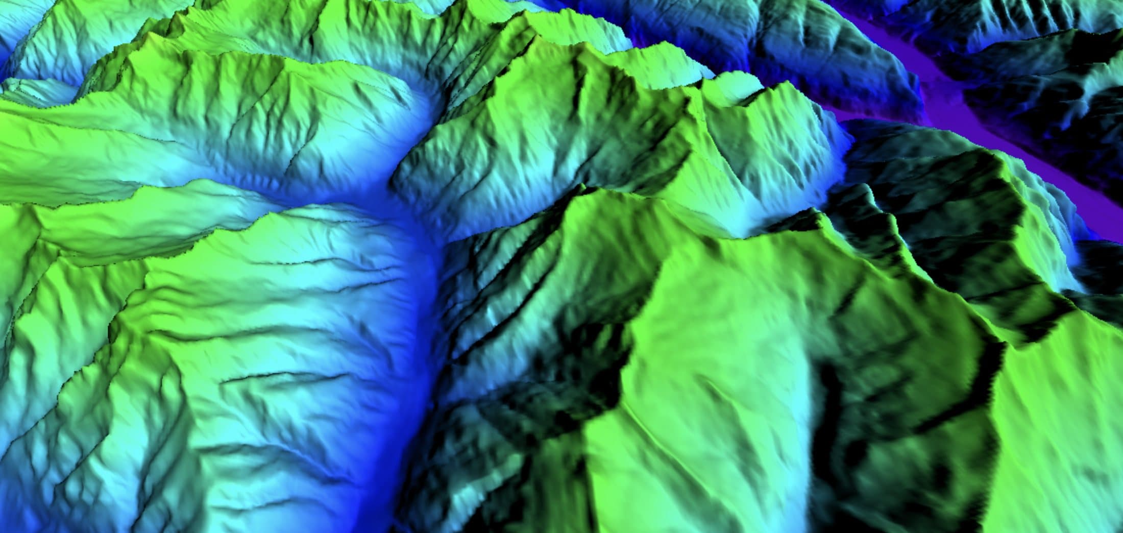
3D terrain in the BEYOND map with the elevation layer: valleys in blue, ridges in green
In the map

Sun and shadow

The real sun position and the shadows on the terrain for any date and time. Play the day, jump to sunrise or sunset, or use flat light.

Sun and shadow
In the map

Lifts and pistes

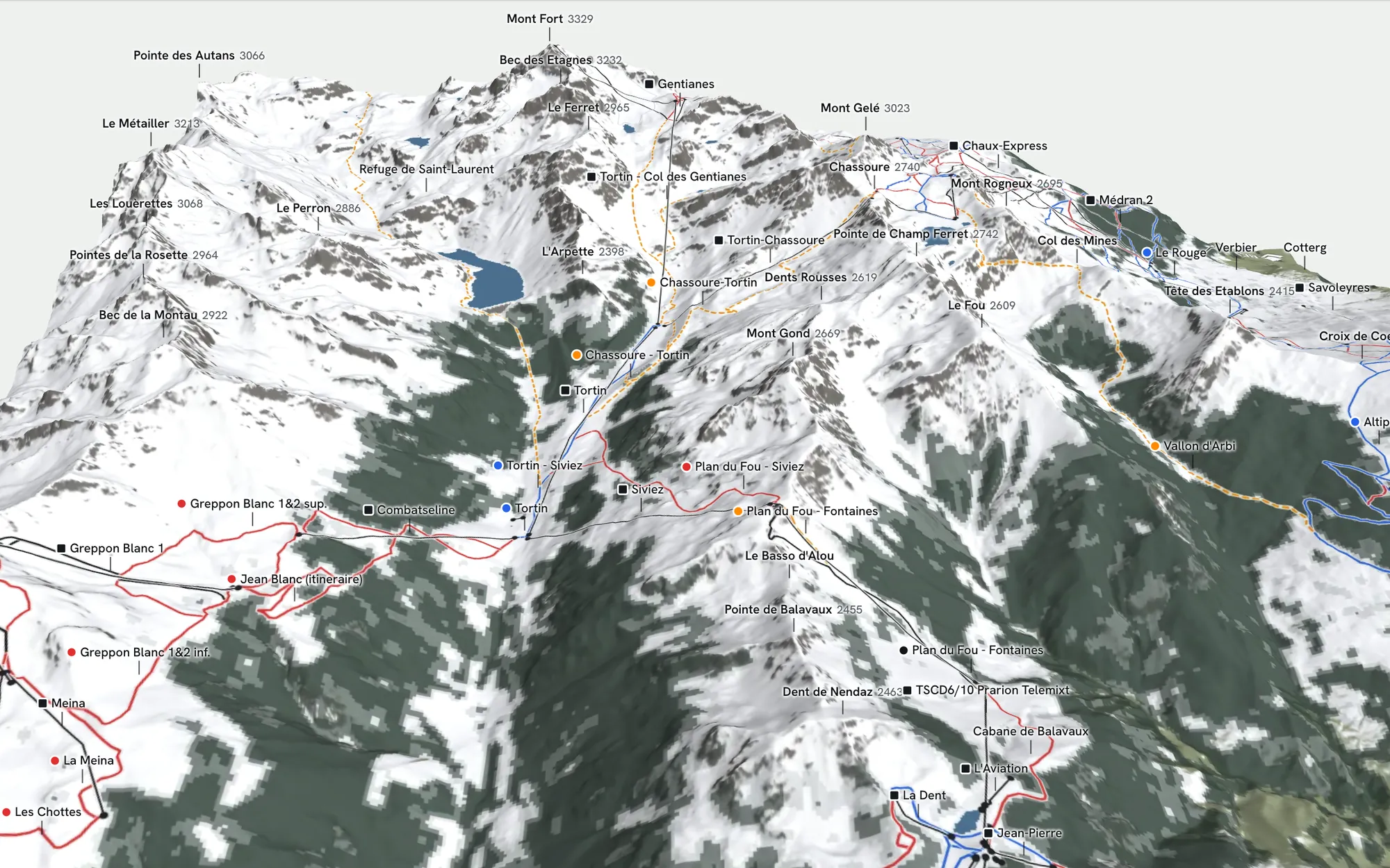
Lifts and pistes are drawn on the 3D terrain with their name and type on hover, with the slope layer on top, so the top station, the face below it and the way back to a lift are in one view.

Lifts as black cables, pistes in blue and red and ski routes as orange dashes on the terrain around Mont Fort in the BEYOND map
In the map

Slope angle, aspect and elevation

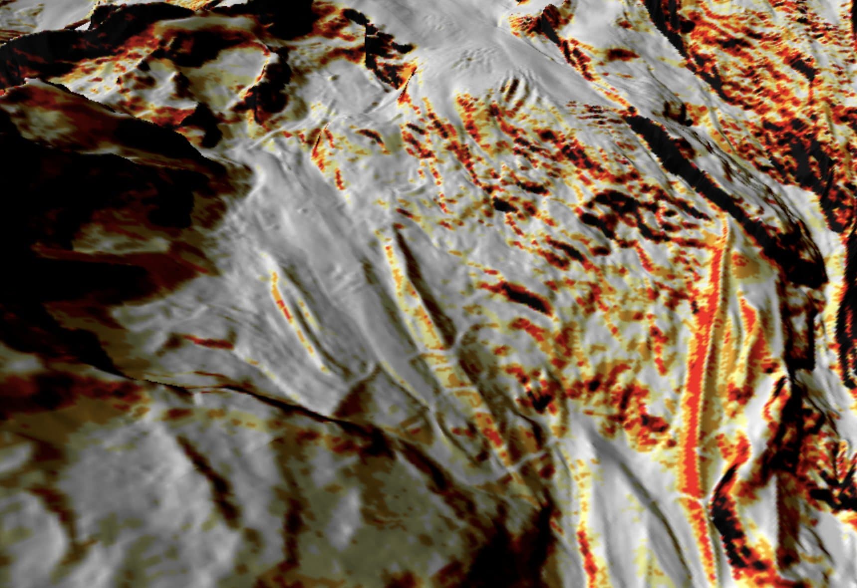
A slope angle layer colours the terrain by steepness in the classes 25, 30, 35, 40 and 45°. Aspect and elevation have their own layers. Click a point to inspect its elevation, slope and aspect.

  • Classes from 25° to over 45°
  • Aspect and elevation layers
  • Inspect any point
Slope angle map
Slope angle layer in the BEYOND map: steeper ground in yellow, orange, red and black over grey shaded terrain
In the map

Avalanche danger on the map

Today's or tomorrow's danger level from the European warning services, drawn on the slopes with the critical aspects and elevations, or an archived date. Inspect a point for the full bulletin there: the danger per elevation, the avalanche problems, the critical aspects and the level for tomorrow.

  • All European warning services
  • Today, tomorrow or an archived date
  • Critical aspects and elevations on the slopes
Avalanche danger map
In the map

Snow, weather, stations and webcams

New snow of the last 72 hours, a snowfall forecast with a 1 to 7 day slider, snow stations with live snow depth and a 7-day chart, webcams with a live picture, and a weather forecast for any point with hourly sun, precipitation, snow versus rain, wind and gusts at about 3,000 m, freezing level and snowfall line.

Snow and weather
In the map

Protected areas

Legally binding protected areas, voluntary wildlife rest zones and reserves, with their rules on hover.

Protected areas
In the map

Routes and times

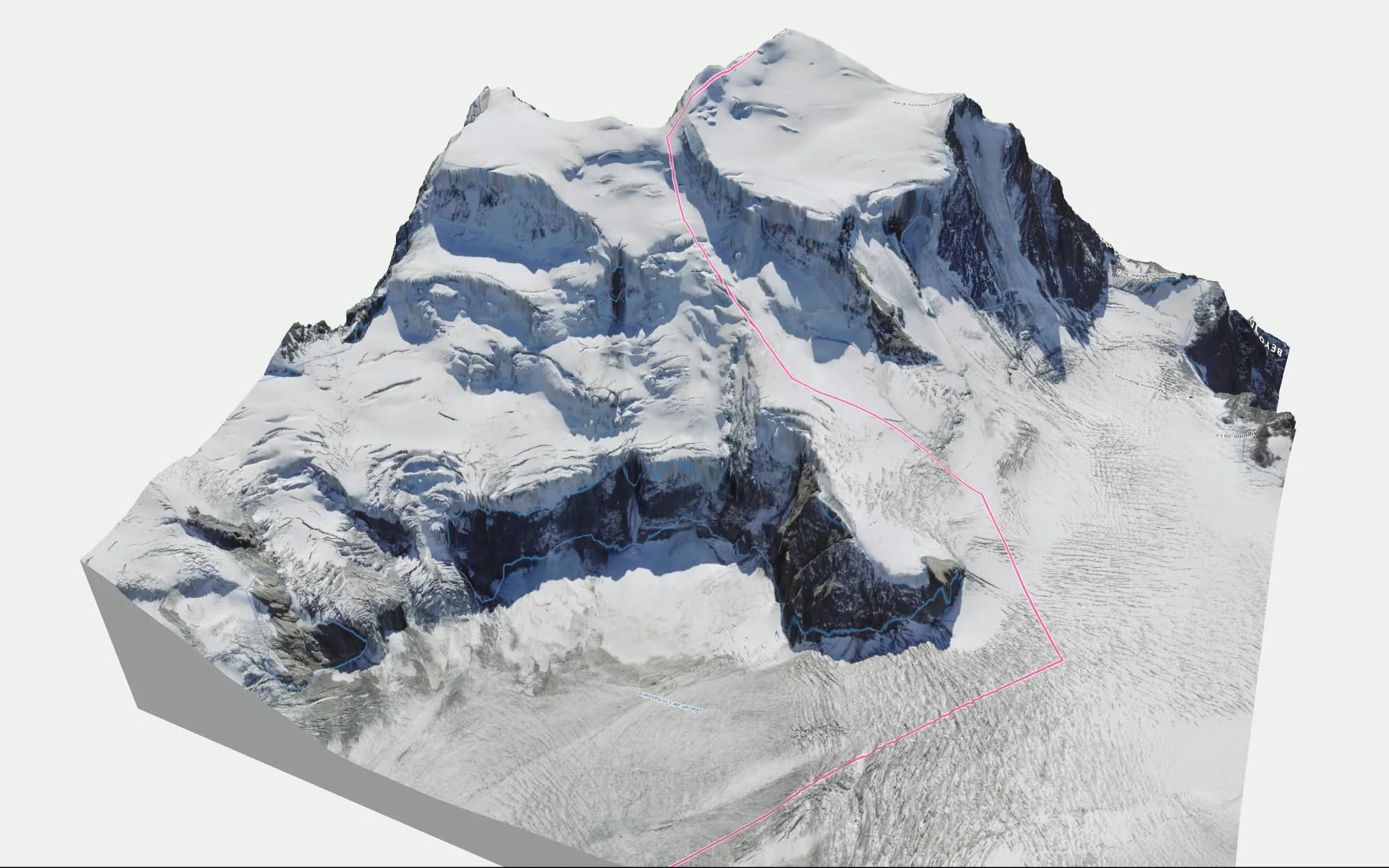
Draw a route or import a GPX. The map gives distance, ascent and descent, the steepest section, an elevation profile coloured by slope, tour times for ski tour, splitboard or freeride after DIN 33466 with your own pace, and the SLABS risk along the route. Routes are saved in your browser and can be exported as GPX.

  • Profile coloured by slope
  • Tour times (DIN 33466)
  • SLABS along the route
A route drawn as a pink line down the Corbassière glacier on the 3D terrain of the Grand Combin in the BEYOND map
In the map

SLABS avalanche terrain analysis

Draw an area of up to 8 × 8 km, enter today's conditions, and the map draws the SLABS risk, the MSA40 steepness, the overlap with the critical aspects, terrain folds, release-area size and slope. SLABS is the method published by Skitourenguru (Degraeuwe, Schmudlach, Winkler, Köhler 2024). It estimates where a skier is more likely to trigger a slab; it has no runout model.

What SLABS shows and what it doesn't
In the map

Offline download

Download an area of up to 16 × 16 km at medium resolution or 6 × 6 km at high resolution as a .usdz for iPhone (with AR), an .html page for any phone (with the names of lifts, pistes and peaks, and your position from the phone's GPS), a .glb for 3D apps and a .jpg map with a scale bar. The map itself needs a connection.

Offline download
In the map

Search

Peaks, huts, passes, villages and coordinates (LV95, LV03, WGS84). The result sets a pin you can use for the weather and the inspect tool. A link shares your current view.

On this website

Bulletin pages per region

Read the official avalanche bulletins on our bulletin pages: SLF for Switzerland, avalanche.report for Tyrol and Météo-France for France. Search by region and see the danger level, the avalanche problems and, for Tyrol and France, the bulletin text, with a link to the original. No account needed.

  • Switzerland, Tyrol and France
  • Checked twice a day
  • Links to the original bulletin
Today's avalanche bulletins

What's coming

What is being built and what comes later.

  1. Building now
    • Aerial base map: 1 m summer imagery in the mountains, coarser elsewhere
  2. Next
    • Routes saved to your account and shared with friends
    • A place to learn: slope angle, aspect and the bulletin explained on the map
    • A community page: updates, your pictures and routes, current conditions
  3. Later
    • Bulletin pages for more regions on this website
    • A native app

Pricing

What is free now, and what may cost money later.

Free now

The map, all layers, routes, the SLABS analysis and the offline download are free. The map asks you to create a free account; there is no credit card and no trial period.

Paying for it, later

Some things we would like to add, winter overlays for example, cost us too much to give away for free. We are weighing a paid tier, a pay-what-you-want setup and brand partnerships. Before anything changes, this page will say what stays free.

Try it

Free, with a free account

Open the map, look at the terrain and draw your route. It's free; the map asks you to create a free account.