BEYOND
Ski resorts · 3D map · Free in your browser

3D piste map

Lifts and marked pistes with their names on real 3D terrain, so you see the shape of the mountain instead of a painted panorama. Turn on slope angle or today's avalanche danger to see what the terrain next to the pistes is like, and the webcams to see what it looks like right now.

Open the map Free · in your browser · free account

A printed piste map is drawn to be easy to read, not to scale. Distances shrink, steep pitches look like flat ones and whole sectors disappear behind a ridge. In 3D the lifts and pistes sit on the real terrain, so you can see how runs connect, how steep they are and what lies between them.

Lifts and pistes in 3D

Lifts and marked pistes are drawn on 3D terrain, with their name and type when you hover. Turn the view to see a run from the bottom, from the side or from the top, and set the sun to the hour you ride to see which runs are in the shade.
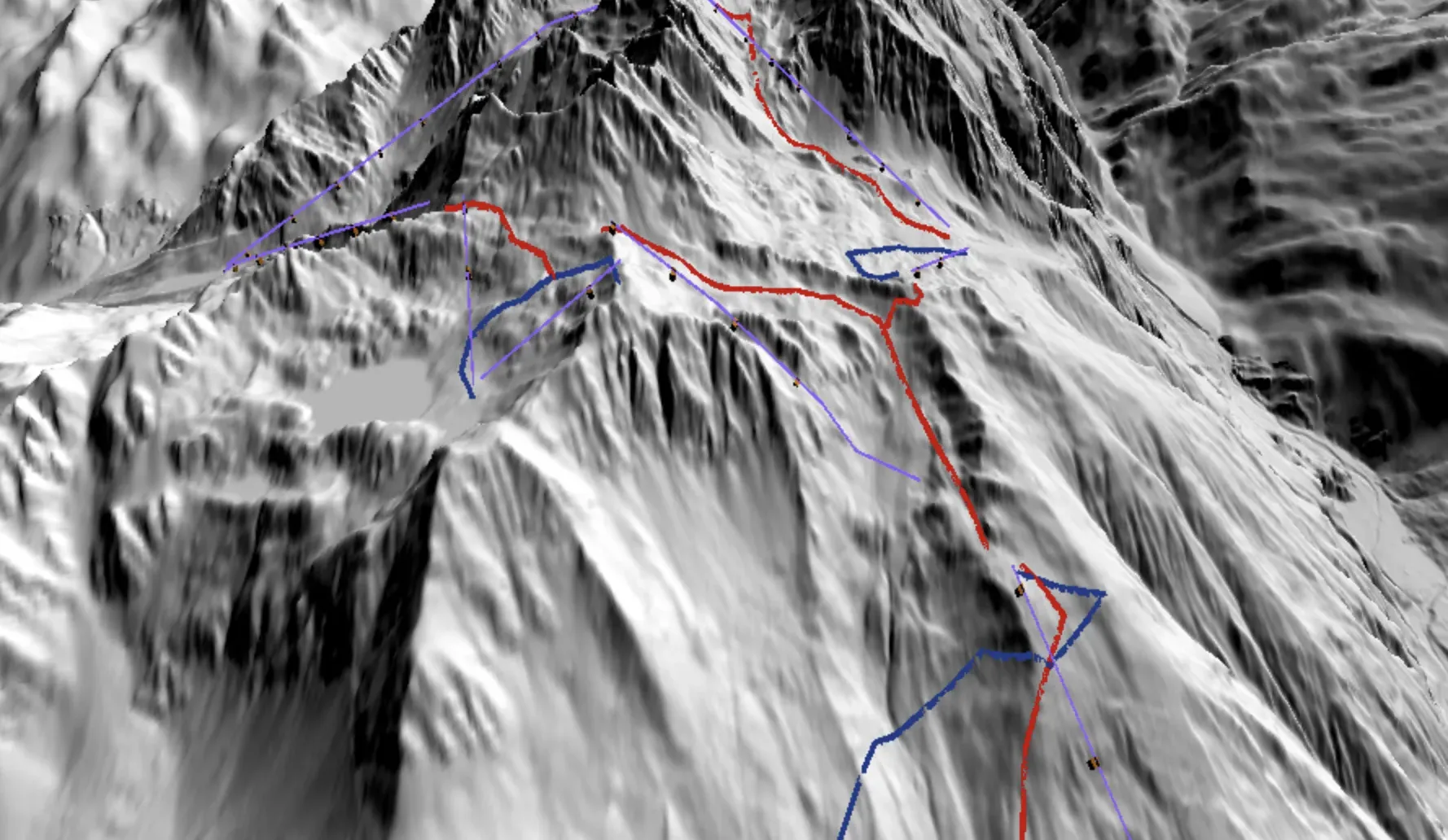
Lifts in purple and pistes in red and blue on shaded 3D terrain in the BEYOND map

Plan the day on the mountain

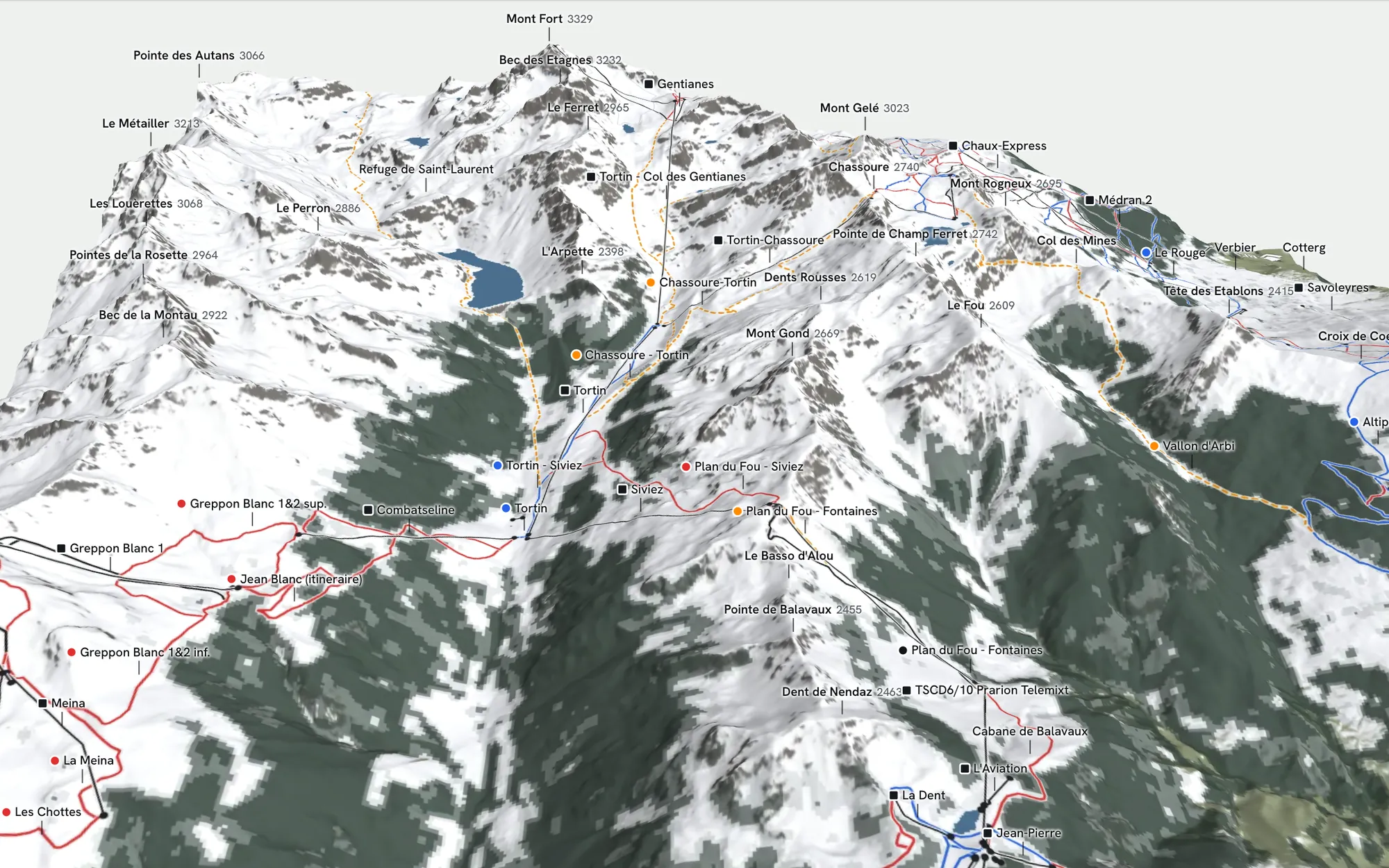
See which lifts connect to which runs and where a run comes out, before you get to the resort.

Lifts as black cables, pistes in blue and red and ski routes as orange dashes on the terrain around Mont Fort in the BEYOND map

The terrain next to the pistes

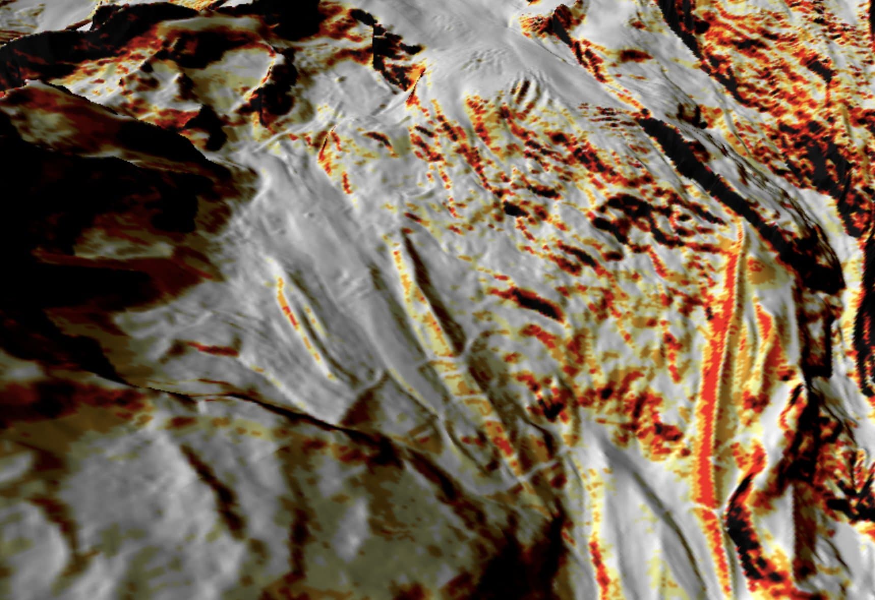
The slope angle layer shows how steep the off-piste terrain around the resort is, and today's danger from the warning services is drawn on it (avalanche danger map). Off-piste terrain is not secured or patrolled; protected areas and wildlife rest zones are on their own layer.

Slope angle layer in the BEYOND map: steeper ground in yellow, orange, red and black over grey shaded terrain

How it works

  1. 01Open your resort

    Go to a ski resort in the Alps.

  2. 02Turn the mountain

    Look at the lifts and pistes from different sides.

  3. 03Add slope angle

    Switch on slope angle or today's avalanche danger to see the terrain next to the pistes.

Who builds BEYOND

BEYOND is built by Luuk van der Poel and Ziggy Triou, two backcountry snowboarders. It started as the map they wanted for their own days in the Alps after FATMAP shut down.

About the founders
Try it

Free, with a free account

The map is free and runs in your browser; it asks you to create a free account, and there is nothing to install. The bulletin pages on this site need no account.