
Contents
The slope angle layer colours every slope in the Alps by steepness in five classes: 25–30°, 30–35°, 35–40°, 40–45° and over 45°, computed from 10 m terrain in Switzerland, Austria, France and Italy, 2 m on demand in Switzerland, Austria and France, 30 m in the gaps. Slab avalanches that skiers trigger mostly release on slopes of 30° and steeper, so this is the first layer to check for a line or a skin track.
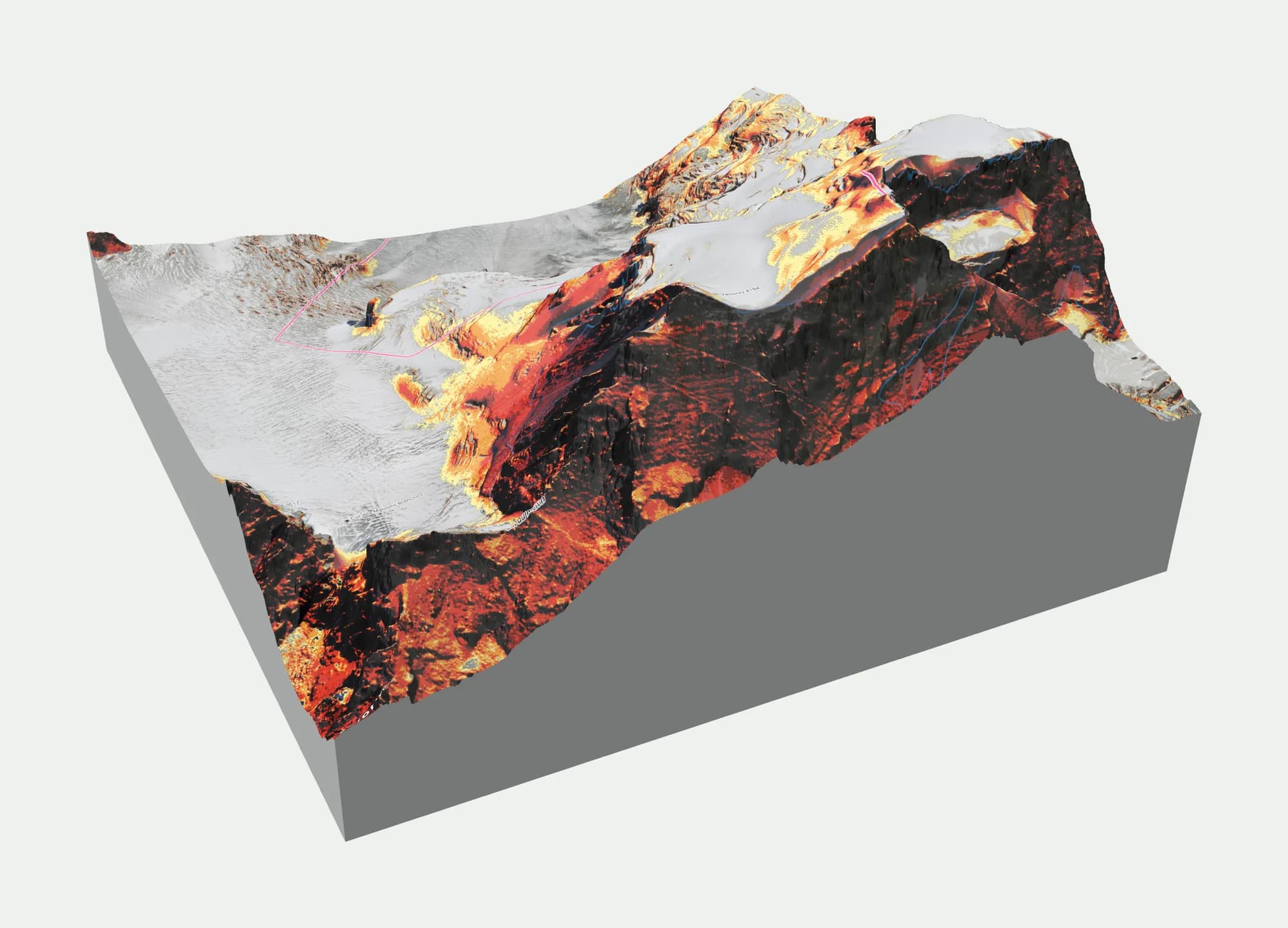
What the colours mean
The edges at 30° and 40° are the ones the European danger scale uses for steep and extremely steep terrain, and 35° is the SLF's mark for very steep terrain; the map adds 25° and 45°. Below 25° the terrain stays uncoloured. Each class is a flat colour with a hard edge, never a gradient, so you can read a boundary on the map.
| Class | Colour | What it means for a skier |
|---|---|---|
| Below 25° | White (uncoloured in the map) | Below the angles at which slabs usually release. Avalanches from steeper slopes above can still run into it. |
| 25–30° | Yellow | Moderately steep. Slab releases are rare here, but check what is above. |
| 30–35° | Orange | "Steep" in the bulletin's terms. Slab avalanches release from 30° on; at danger level 3 the bulletin names these slopes on the critical aspects. |
| 35–40° | Red | Very steep. The range where most skier-triggered slab avalanches release. |
| 40–45° | Dark red | Extremely steep. Also where most accidents cluster together with 35–40°. |
| Over 45° | Black | Mostly rock and couloirs. Snow sluffs more than it slabs, but slabs still release in snow between rock bands. |
Why 30° matters
The European avalanche danger scale describes the danger per level in terms of steep slopes, which the services define as slopes steeper than about 30°. At level 2 (moderate) the bulletin names specific steep slopes; at level 3 (considerable) many steep slopes on the aspects and elevations it names. So the slope angle layer is how you translate the bulletin into terrain: switch it on, then look at which parts of your line are 30° or steeper on the aspects the bulletin flags.
The angle that matters is not only the angle under your skis. A slope that is 28° where you stand can be hit by a slab that releases on a 38° roll above it, and a skier on a flat bench below a steep face can trigger a slab above. That is why the SLABS analysis looks at the steep part of the slope area around a point (the 85th percentile of its angles, within about 40 m) rather than the angle at the point itself. See what SLABS shows.
Resolution: what 10 m and 2 m show
The map is built from 10 m terrain for Switzerland, Austria, France and Italy, and from 30 m Copernicus data in the remaining gaps such as Berchtesgaden and Slovenia. When you zoom in over Switzerland, Austria or France, a button loads 2 m terrain for that view.
Resolution changes what you see. At 30 m a short steep step averages out with the flatter ground around it, so a 15 m roll of 40° can show as 32°. At 10 m most rolls and gullies appear. At 2 m you see short steep steps, small cliff bands and the shape of a convex roll. The map shows a notice when you are zoomed in on coarse data.
In the field, measure with an inclinometer on the slope you plan to ski. The layer tells you where to look; it does not replace the measurement.
Use it with aspect and the avalanche danger
Three layers belong together: slope angle, aspect and the avalanche danger. The danger layer draws today's or tomorrow's danger level from the European warning services on the slopes, with the critical aspects and elevations. Switch between the slope angle and the danger layer, or click a point to inspect its elevation, slope, aspect and the full bulletin there.
Along a route, the elevation profile is coloured by slope and the map names the steepest section, so you can see at a glance where a skin track gets too steep for kick turns, or where a descent crosses 35°.
What it doesn't show
- The angle comes from an elevation model. Cornices, small cliff bands and rock steps shorter than the resolution can be missing, and on glaciers the model can be wrong.
- Slope angle says nothing about the snowpack. What a 35° slope means today depends on the bulletin, the aspect and the snow.
- Forest is not part of the angle. Dense forest changes the avalanche picture; the winter relief base map shows forest separately.
- The classes have hard edges; the terrain does not. A slope mapped at 29° can be 31° where you stand.